IBM HRL’s MEMS Navigation Sensor Targets GPS Gaps — What the Evidence Shows
IBM-owned HRL has detailed its compact MEMS navigation sensor and a static eight-hour bias test. DeepTech examines what is demonstrated, what GPS-free navigation still requires, and what remains unverified.

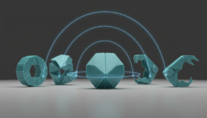
Original DeepTech conceptual illustration. Not a photograph of HRL hardware or a measured test result.
MEMS inertial navigation without GPS is attracting new interest as autonomous machines move into places where satellite positioning cannot be trusted. On 5 November 2026, IBM Research described a self-calibrating sensor developed by its HRL Laboratories subsidiary. The company argues that correcting a longstanding measurement problem could make compact inertial units useful for longer navigation tasks. That is an important engineering claim, but the available evidence does not establish that a small device can match GPS positioning in every real-world environment. IBM Research’s technical explainer is the principal source for the November account.
This is also not an entirely new product launch. HRL announced its AXI-R100 inertial measurement unit on 1 June 2026 and said that pre-production orders were available. The November article provides a closer explanation of the calibration work, while production is expected in 2027 according to IBM. Those distinctions matter when evaluating claims of a finished navigation solution.
Image note: the featured image is an original DeepTech conceptual illustration. It is not a photograph of the AXI-R100, an experimental plot or a measured navigation result.
Why does navigation fail when GPS disappears?
Satellite navigation requires usable signals and suitable conditions for a receiver to estimate its position. Tall buildings can obstruct or reflect signals, while tunnels, indoor areas, interference and deliberate jamming can leave vehicles with degraded or unavailable GPS. A drone or autonomous vehicle cannot assume that a location update will always arrive from space.
Inertial navigation offers a different kind of measurement. Instead of waiting for an external positioning signal, an inertial measurement unit (IMU) measures how its host platform accelerates and rotates. Given a starting position and an initial orientation, a navigation system can estimate changes in position over time. The key advantage is independence from a continuous satellite signal; the difficult part is keeping small errors from accumulating.
What is inside a MEMS inertial measurement unit?
MEMS, short for micro-electromechanical systems, describes tiny mechanical structures fabricated on chips. A typical six-axis IMU combines three accelerometer channels, which measure acceleration, with three gyroscope channels, which measure angular velocity. Their orthogonal axes allow motion to be represented across three dimensions. This does not automatically produce a reliable geographic coordinate: an inertial navigation solution still needs initialization, calibration, time integration and careful control of measurement error.
The attraction of MEMS hardware is its compact size and potential compatibility with semiconductor-scale manufacturing. HRL says its AXI-R100 offers performance intended for applications that previously relied on larger or more expensive inertial equipment. The manufacturer’s June product announcement describes preparation for deployment and tests under vibration, shock and temperature stress. These are company-reported qualifications, not a substitute for independently published field results.
The critical limitation: bias drift
An inertial sensor can report a small nonzero output even when it should be measuring no motion. That offset is known as bias. Its value may change with temperature, vibration, time or other conditions. Because navigation estimates accumulate sensor readings, small offsets can ultimately create large position errors. An accelerometer bias may produce a growing velocity and position error; a gyroscope error can misdirect how acceleration is interpreted.
IBM says HRL addresses this issue with a continuous self-calibration approach called AutoCal. The research account describes measurements designed to identify the changing bias and remove its contribution from subsequent readings. This is a claim about improving the quality of inertial measurements. It should not be read as proof that every source of navigation error has disappeared: sensor noise, scale-factor errors, initialization uncertainty and challenging motion can still matter.
What did the eight-hour experiment actually show?
The clearest public illustration in IBM Research’s November report is a chart comparing sensor bias behavior with and without AutoCal during an eight-hour static test. In that demonstration, the calibration system suppresses the bias variation shown for the stationary sensor. The report treats this as evidence that extended operation may become practical without the same drift limitation affecting conventional compact sensors.
A static sensor test is valuable, but it is not the same as an eight-hour autonomous flight, road journey or underwater mission. The public article does not supply an independently verified eight-hour trajectory with absolute position-error statistics across difficult real-world conditions. Nor does it establish that the device always outperforms satellite positioning. The technically sound conclusion is narrower: the company has presented evidence of reduced bias drift under the stated test conditions.
What is the AXI-R100’s commercial status?
HRL named its hardware platform AXI-R100 in a June 2026 announcement, describing it as a compact inertial unit for navigation in environments where GPS is degraded. The company said pre-production orders were open and highlighted intended aerospace, automotive and other demanding applications. IBM’s November explanation says wider production is expected to begin in 2027, not that high-volume deployment has already been achieved.
HRL became an IBM subsidiary after IBM completed its acquisition on 26 August 2026. That corporate change provides useful context for why the research is appearing through IBM Research, but ownership does not strengthen the sensor’s measured performance. Product readiness must be judged from technical specifications, qualification results, availability and field evidence rather than branding.
Where could GPS-independent sensing be useful?
Potential applications include drones operating between buildings, vehicles passing through tunnels, industrial robots moving through signal-poor facilities and aircraft that need a fallback when satellite information is interrupted. A compact inertial unit may serve as a bridge between trustworthy external position updates, or as one measurement source in a broader navigation stack. The best architecture depends on the mission’s acceptable uncertainty and failure modes.
For example, a rescue drone could benefit from knowing that its motion estimate remains usable during a short signal outage. That scenario is different from claiming that an IMU alone can navigate indefinitely to centimeter precision. Our analysis of autonomous drones in disaster response addresses why environmental conditions and operational reliability must be assessed before deployment.
What independent testing is still needed?
A convincing evaluation would freeze the test protocol before data collection and then compare the IMU against an appropriate reference trajectory. The report should disclose test duration, distance, speed, changes in direction, initial calibration, temperature, vibration, GPS availability and the evolution of position and orientation errors. Multiple runs, difficult routes and error distributions would reveal whether a favorable static result transfers to navigation.
The US National Institute of Standards and Technology emphasizes that localization systems with inertial sensors should be examined over long routes, complex paths, different speeds and varied movement patterns, because drift can worsen with time. That guidance is for localization testing generally; it is not an independent test of the AXI-R100. NIST’s testing guidance offers useful criteria for evaluating future claims.
Independent observers would also need to distinguish sensor stability from positioning accuracy. An instrument can have a much lower bias and still accumulate errors due to other factors. Comparing it with GPS requires stated scenarios and comparable metrics, rather than using the word “rival” as an all-purpose performance rating.
What does the evidence support today?
The verified timeline is straightforward: HRL introduced a MEMS inertial navigation product in June; IBM acquired HRL in August; and IBM Research published a detailed calibration explainer in November 2026. The technical account includes an eight-hour stationary bias demonstration and a planned production timeline. These are meaningful developments for compact navigation hardware, while independent long-duration moving-vehicle benchmarks and general GPS-equivalence remain unverified in the public materials reviewed here.
That separation between engineering potential and demonstrated use is central to how DeepTech evaluates laboratory research and industrial adoption. The next decisive evidence will be reproducible navigation performance in real operating conditions—not merely a promising calibration chart.